Synopsis
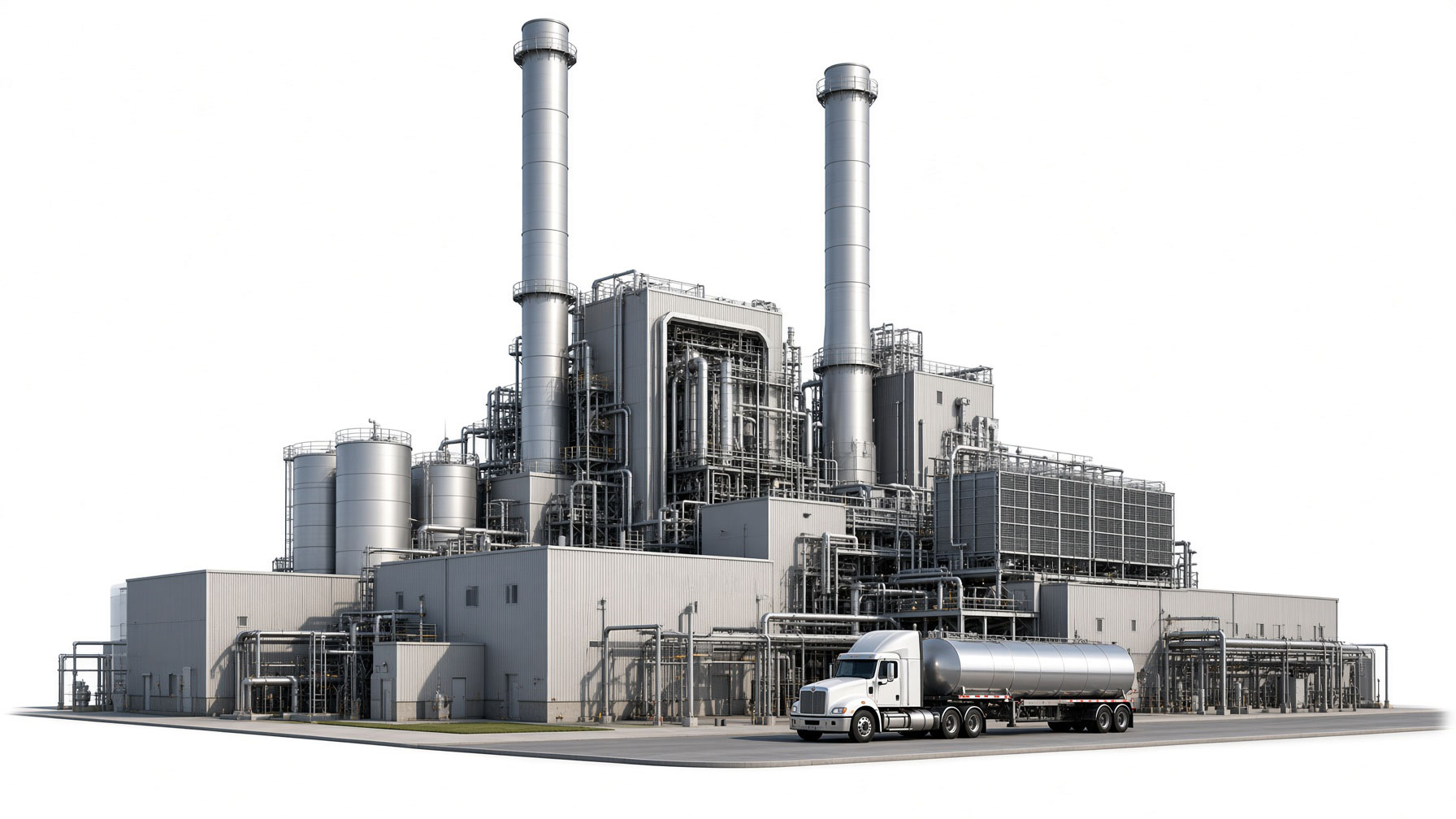
Sunridge Power is a proposed natural-gas power plant on about 164 acres southwest of Red Rock, in unincorporated Pinal County. To be specific, as you leave Red Rock Village, it will be just beyond the cow feedlot. The developer wants to build one large generating unit first, then add a second one as soon as the first one is operational. Together, the two units would produce enough power for about half of Tucson in the summertime.
A new high-voltage power line, about five miles long, would connect the plant to the larger electric grid, and multiple of the proposed paths route the lines just south of Red Rock Village.
Pinal County approved the land use in June 2026 with nearly zero community awareness, but that approval alone does not allow construction to begin. The project still needs several state and local approvals, including permission for the power plant and power line, an air-pollution permit, approval for its water supply, and other construction permits.
The developer says construction could start in 2028 and the plant could open in 2032. Those are estimates, not guaranteed dates.
Location & Context
Project Location & Regional Context
Explore the proposed Sunridge Power site and its relationship to Red Rock, Missile Base, nearby roads, communities, and regional landmarks. Map annotations are provided for geographic context and should be confirmed against official project records.
Links
Find current Arizona laws by statute number, keyword, subject, or an exact quoted phrase.
Developer information
Official state case
Public hearing
County information
Public Concerns
-
1 Insufficient Biological Analysis of Native Wildlife
Does the application adequately identify and evaluate the native wildlife that may use the project site, nearby washes, and surrounding habitat?
Community reviewers identify omitted or minimized discussion of yellow-billed cuckoo, Bendire’s thrasher, cactus ferruginous pygmy-owl, bats, migratory birds, and other wildlife.
The concern is not that every reported species is proven to occupy the plant parcel. It is that the biological record must use an appropriate study area, seasonal timing, survey method, and source inventory before concluding that presence or impact potential is low.
The community submission points to reported yellow-billed cuckoo use near Los Robles Wash, a Bendire’s thrasher observed during project surveys, suitable cactus ferruginous pygmy-owl habitat near Ironwood Forest National Monument, nightly bat activity near the wash, and broader migratory-bird use. It asks for the underlying occurrence records, complete survey protocols and appendices, species-specific lighting and noise analysis, collision analysis, and any consultation with wildlife agencies.
These are community-raised observations and interpretations that should be tested against official records and qualified biological review. Before certification, the applicant should explain which species and habitats were evaluated, why any species were omitted, whether surveys covered the transmission corridor, and what enforceable protections would apply if protected or sensitive wildlife is found.
-
2 Transmission Line Corridor Not Adequately Studied
Do the biological, noise, collision, and visual studies cover the full GenTie corridor rather than only the main plant area?
The proposed transmission line is a major project component, yet community reviewers say key studies use a plant-centered study area that does not fully cover the corridor.
A five-mile transmission connection can create impacts beyond the generating-site boundary. Community reviewers ask whether the full route and every alternative were surveyed for wildlife, washes, lighting, noise, collision risk, views, access, and nearby properties.
Particular questions concern migratory-bird collision risk near washes, bat activity near Los Robles Wash, the location of the proposed western substation, and whether biological surveys followed each potential route. The record should show route-specific methods, results, alternatives, and mitigation.
Before approval, the applicant should provide a corridor-wide analysis that uses consistent boundaries and explains how route selection will avoid, minimize, and monitor impacts.
-
3 Riparian Habitat and Hydrological Impacts
Does the application accurately characterize nearby washes and river habitat while accounting for groundwater draw, runoff, sediment, and contamination?
Community reviewers dispute a broad characterization that no riparian habitat is nearby and request analysis of Los Robles Wash, the Santa Cruz River, local wells, and construction runoff.
Los Robles Wash and the Santa Cruz River are raised as nearby features used by wildlife and migratory birds. The public record should distinguish the plant parcel itself from adjacent riparian or xeroriparian functions and explain the geographic basis for any statement that habitat is absent or outside the project vicinity.
The same concern includes hydrology. Reviewers ask for cumulative groundwater analysis, effects on nearby wells and sensitive corridors, sediment and contamination controls at wash crossings, and reconciliation of differing statements that project water use would be either 30 percent or 16 percent less than historical agricultural use.
Those percentages are characterized here as community readings of the application and should be checked against the filed record. A useful response would cite the precise pages, baseline, demand assumptions, drought scenarios, and enforceable monitoring or contingency measures.
-
4 Ironwood Forest National Monument Omitted from Key Analyses
Why is the nearby national monument absent or minimized in analyses of habitat, connectivity, dark skies, recreation, and visual impacts?
The monument boundary is approximately 0.5 miles from the Sunridge property and less than 6,000 feet from the Phase 1 facility itself, yet it is omitted from multiple application sections.
Ironwood Forest National Monument is relevant not simply as a named landmark but as nearby habitat, a recreation destination, a dark-sky resource, and part of the regional setting. Community reviewers ask the applicant to identify every section in which the monument was included or excluded and the boundary used for each analysis.
The submission notes nearby habitat potentially relevant to cactus ferruginous pygmy-owl, desert bighorn connectivity, xeroriparian migratory-bird habitat, recreation, and a pending dark-sky designation. The designation is described as pending, not complete.
The committee should require consistent treatment of the monument across biological, visual, lighting, recreation, access, and cumulative-impact analyses, supported by maps and source citations.
-
5 Ironwood–Picacho Wildlife Linkage Analysis
Has the application adequately analyzed how fencing, lighting, noise, roads, and transmission infrastructure could affect movement through the acknowledged linkage?
The application acknowledges the Ironwood–Picacho linkage, but community reviewers request movement studies or connectivity modeling addressing project-specific fragmentation risks.
This concern is separate from the page-538 bighorn inventory issue. The question is not whether the linkage exists; it is whether the project record adequately evaluates how the proposed facilities could change its function.
Community reviewers ask for analysis of fencing, nighttime lighting, construction and operational noise, transmission-line collision hazards, and expanded access roads. They also ask the applicant to identify wildlife-agency coordination, movement data, connectivity modeling, and design changes intended to preserve passage.
The committee should require a clear project-specific linkage analysis and enforceable measures tied to measurable outcomes, rather than relying only on a passing acknowledgment that the linkage is present.
Ironwood–Picacho linkage views
Looking down the linkage from Sunridge's Property. The view looks south-southwest past the Santa Cruz River and Brawley Wash toward Pan Quemado and Cerro Prieto. The Samaniego Hills are in the immediate background, followed by Ragged Top or Wolcott Peak, and the Silver Bell Mountains in the distant background. Photograph by John Hadwin. Looking down the linkage. The view looks south-southwest past the Santa Cruz River and Brawley Wash toward Pan Quemado and Cerro Prieto. The Samaniego Hills are in the immediate background, followed by Ragged Top or Wolcott Peak, and the Silver Bell Mountains in the distant background. Photograph by John Hadwin. -
6 Inconsistent Use of Core Study Definitions
Are “project vicinity,” “study area,” and similar boundaries defined and applied consistently across the application?
Community reviewers say nearby habitat, the transmission corridor, the national monument, and riparian corridors receive inconsistent treatment depending on the section.
A conclusion can change substantially when the boundary changes. Community reviewers point to habitat approximately 0.8 miles away being treated as outside the project vicinity, transmission impacts being excluded from a plant-centered study area, the adjacent national monument being omitted, and nearby riparian corridors being dismissed.
The applicant should provide a glossary and map for every core geographic term, list the radius or polygon used in each discipline, and explain any difference. Where different study areas are scientifically justified, that justification should be explicit rather than inferred.
Consistent definitions are necessary for the committee and public to compare findings across wildlife, water, noise, lighting, views, recreation, and cumulative impacts.
-
7 Desert Bighorn Missing from the Five-Mile Species Study
With bighorn completely missing from the Species of Concern on page 538 of the Sunridge CEC Application, how can the environmental compatibility be certified?
The Species of Concern table on page 538 of the Sunridge CEC Application does not include desert bighorn sheep, even though documented photographs place them inside the table’s stated five-mile study radius.
Desert bighorn sheep are completely missing from the Species of Concern table on page 538 of the Sunridge CEC Application. The application itself places the proposed site in the Ironwood–Picacho linkage, so this concern does not need to re-establish the linkage. The immediate problem is whether a five-mile Species of Concern study that omits a documented large mammal present within that radius can be treated as serious or complete.
Kiley Hyatt states that three witnesses observed a desert bighorn sheep on September 7, 2019, approximately three miles from the proposed plant site. Hyatt is willing to sign a sworn affidavit concerning the authenticity and circumstances of the sighting. The downloadable original HEIC contains embedded camera metadata reporting an Apple iPhone 7, a device-recorded time of September 7, 2019 at 7:57:35 a.m., and GPS coordinates inside the study radius. The matching JPEG is shown without labels, with explanatory labels, and as a labeled crop. The original file and its checksum are provided for independent inspection.
John Davis also photographed desert bighorn sheep well within five miles of the proposed Sunridge plant on July 11, 2023. The original-capture timestamps embedded in all three supplied files report that date. Davis reports that the camera used does not record geolocation, and the files contain no usable GPS coordinates. Their precise location is intentionally withheld from filenames and public captions to help protect the herd.
Together, the 2019 geolocated file, witness account, and 2023 photographic record document desert bighorn presence within the area Sunridge says its table covers. Yet page 538 does not list or evaluate the species. Without consistent explanation for that omission, a complete disclosure of the records and methods used to compile the table, and a species-specific assessment responsive to this evidence, the application lacks sufficient information to support certification of environmental compatibility. A.R.S. § 40-360.06 requires consideration of effects on wildlife and the area’s total environment; that determination cannot rest on an incomplete Species of Concern inventory.
Original evidence file
Download original Sasco sighting HEICOriginal camera file supplied by photographer Kiley Hyatt for authenticity inspection.
Sasco sighting — Kiley Hyatt
Original-view JPEG of the reported September 7, 2019 Sasco bighorn sighting. Photograph by Kiley Hyatt. The animal is small and distant in the uncropped frame. Location and distance descriptions are supplied by the photographer. Labeled full-frame view identifying the reported sheep and nearby landmarks. Photograph and annotations by Kiley Hyatt. Labels, directions, and distances are community-supplied and have not been independently verified. Labeled crop of the reported Sasco sheep. Photograph and annotations by Kiley Hyatt. The identification is attributed to the photographer and witnesses and is not presented as an agency determination. Sasco sighting and proposed plant location
Community-created Google map showing the reported bighorn sighting in relation to the proposed plant. Map locations and measurements should be independently checked.
Images within 5 miles - missing geolocation metadata
Desert bighorn sheep photographed by John Davis on July 11, 2023, well within five miles of the proposed Sunridge plant. The original-capture date is embedded in the file. The camera does not record geolocation; the precise location is withheld to help protect the herd. Desert bighorn sheep photographed by John Davis on July 11, 2023, well within five miles of the proposed Sunridge plant. The original-capture date is embedded in the file. The camera does not record geolocation; the precise location is withheld to help protect the herd. Desert bighorn sheep photographed by John Davis on July 11, 2023, well within five miles of the proposed Sunridge plant. The original-capture date is embedded in the file. The camera does not record geolocation; the precise location is withheld to help protect the herd. -
8 Nonbinding, Nonspecific Mitigation Measures
Which environmental protections are mandatory, measurable, assigned to a responsible party, and enforceable?
Community reviewers identify recurring qualifiers such as “when feasible,” “where possible,” and “to the extent practicable.”
Mitigation language does not provide reliable protection when it leaves performance optional, does not identify who must act, or supplies no measurable standard, deadline, monitoring method, reporting requirement, or consequence for failure.
The application should provide a mitigation table that connects each identified impact to a specific measure, responsible party, implementation date, verification method, public reporting mechanism, and enforcement authority. Any qualifier should be defined and supported by a documented decision process.
The committee can then distinguish enforceable certificate conditions from aspirations or best-effort statements and decide whether the remaining impacts are environmentally compatible.
-
9 Cumulative Environmental Impacts
Does the record evaluate the combined regional burden on wildlife, water, recreation, air quality, noise, and dark skies?
Community reviewers say the application acknowledges cumulative effects but provides limited analysis of other existing and reasonably foreseeable development.
A project can meet an individual standard while still adding to a broader regional burden. The requested cumulative assessment should identify the geographic and time horizon, existing facilities, approved projects, reasonably foreseeable projects, shared transmission and water demands, and affected resources.
The analysis should address wildlife linkage function, groundwater draw, recreation and access, air pollution, noise, lighting, views, and construction overlap. It should explain which projects were included and excluded and avoid treating each resource with an inconsistent regional boundary.
This concern does not assume a cumulative violation. It asks for enough transparent analysis to let the committee judge the total environment and consider enforceable conditions based on combined effects.
-
10 Flooding, drainage, and site elevation
Red flag: Sunridge’s flood analysis relies on official flood data that does not demonstrate what happens here when a 65,000 CFS event meets today’s altered upstream conditions.
The flood data used for Sunridge is not adequate for this siting decision. The official flood data is out of date for this site because it does not account for the site-specific effect of upstream mitigation built after 1983, which may force more floodwater downstream toward Red Rock, Missile Base, and the proposed plant. A new hydrologic and hydraulic study is necessary before approval.
The flood data used for Sunridge is not adequate for this siting decision. It does not demonstrate what happens at the proposed plant during a repeat of the approximately 65,000-cubic-feet-per-second October 1983 flood under today’s changed upstream conditions. That is the central danger: a model can follow an official map and still understate the flood that may actually reach this site.
In 1983, upstream mitigation projects that exist today had not yet been built. Part of the recorded upstream flood volume could spread or be retained before it reached Red Rock, reducing the flow that continued downstream. Those later projects now constrain or redirect water upstream. The current public record does not demonstrate that Sunridge’s flood model compensates for the possibility that more of the same 65,000 CFS volume would now be driven downstream toward the still-unmitigated Red Rock and Missile Base area.
The proposed property is close to the Santa Cruz River in both distance and elevation. Lifelong Red Rock residents identified the location reached by the 1983 flood, and that testimony-based high-water location is marked on the map with a blue X. The marked location has not been independently surveyed, but it is material evidence that must be tested—not dismissed—against current elevations and current upstream conditions.
The witnessed 1983 location may reflect only about 75 percent of the 65,000 CFS recorded immediately upstream if roughly 25 percent was dispersed or retained before reaching this area. Under present upstream conditions, a similar event could deliver that additional share downstream and produce a substantially higher water level than the witnessed mark. This is not presented as a completed engineering calculation. It is a specific, consequential scenario that the existing record has not resolved and that requires new site-specific hydrologic and hydraulic modeling.
Before any approval, the committee should require an independent study using the 1983 upstream flow, today’s upstream mitigation, current terrain, existing and finished site elevations, and failure scenarios above the modeled flood level. The study must show whether a raised plant pad or protective wall would redirect water toward Sasco Road, neighboring properties, Red Rock, Missile Base, or the Santa Cruz River. This work is necessary to protect lives, prevent the plant and electrical infrastructure from being overwhelmed, and avoid a potentially catastrophic release or environmental impact during the next extreme flood.
The record must also answer this basic question: If Pima County & the Federal Government require 20-foot-high walls with 10-foot-deep footings, then why wouldn’t properties immediately downstream be required to do the same?
Supporting images
Annotated aerial image labeled “SITE / RIVER PROXIMITY,” showing Sunridge, the Santa Cruz River, Red Rock Village, Ironwood Forest National Monument, and marked site-to-river distances. Evidence image included with permission. Distances and annotations have not been independently verified. Annotated map labeled “HIGH WATER LINE 1983.” The blue X marks the high-water location identified through witness testimony from lifelong Red Rock residents. Evidence image included with permission. The marked location is testimony-based and has not been independently surveyed. Photograph of a water-related closure on Sasco Road. Evidence image included with permission. The date and conditions shown have not been independently verified. -
11 Air Pollution & Health Impact
What would the applicant’s projected pollution mean for the health of people living, working, and learning nearby?
The applicant’s CEC filing estimates annual emissions of particulate matter, nitrogen oxides, carbon monoxide, volatile organic compounds, sulfur dioxide, sulfuric acid mist, hazardous air pollutants, and more than 5.4 million tons of carbon-dioxide equivalent.
These are not abstract numbers. Fine particles can travel deep into the lungs and bloodstream. Nitrogen oxides contribute to ozone and particle pollution. Some volatile organic compounds and hazardous air pollutants are known or suspected to cause cancer or other serious effects. Children, older adults, people with asthma, and people with heart or lung disease can be especially vulnerable.
The application’s estimates do not by themselves prove that the plant would violate a legal standard or that any particular person would become ill. They do establish the scale of pollution that regulators and the public must evaluate. Before approval, the developer should show the modeled concentrations, assumptions, control efficiencies, startup and shutdown emissions, cumulative effects with nearby sources, monitoring plan, and enforceable limits in language the community can understand.
The final county air permit is where enforceable pollution limits, control equipment, monitoring, reporting, and consequences for violations must be established. The state siting process has a separate responsibility to decide whether this location is environmentally compatible. Meeting a numerical permit limit is a legal requirement, but it is not the same as proving that adding another major source beside an established community is the wisest or most health-protective choice.
Applicant’s estimated annual emissions during operation Pollutant Estimated amount Associated health risks Environmental risks Particulate matter (PM) 220 tons/year Can irritate the respiratory system and worsen heart or lung disease. Can reduce visibility and settle on land or water. Coarse particulate matter (PM₁₀) 220 tons/year Can enter the lungs, aggravate asthma, and contribute to respiratory or cardiovascular stress. Can impair visibility and settle on surrounding surfaces. Fine particulate matter (PM₂.₅) 220 tons/year Can travel deep into the lungs and bloodstream; associated with heart attacks, asthma, and premature death. Contributes to haze and can deposit into ecosystems. Nitrogen oxides (NOₓ) 368 tons/year Can inflame airways, trigger asthma symptoms, and increase susceptibility to respiratory infections. Helps form ground-level ozone, particulate matter, and acid rain. Carbon monoxide (CO) 272 tons/year Reduces oxygen delivery in the body; elevated exposure is especially concerning for people with heart disease. Has fewer direct environmental effects than the other listed pollutants. Volatile organic compounds (VOCs) 123 tons/year Effects vary by compound; some can irritate the eyes, nose, and throat, damage organs, or be carcinogenic. Helps form ground-level ozone and smog. Sulfur dioxide (SO₂) 70 tons/year Can make breathing difficult and aggravate asthma, particularly in children. Contributes to particle pollution and acid deposition. Sulfuric acid mist 50 tons/year Can severely irritate the respiratory tract and damage lung tissue at sufficient exposure. Can contribute to acidic deposition and corrosion. Total hazardous air pollutants (HAPs) 19 tons/year Depending on the compounds and exposure, risks can include cancer, developmental harm, and organ toxicity. Some compounds can persist, build up in living tissue, or contaminate ecosystems. Carbon dioxide equivalent (CO₂e) 5,443,653 tons/year Primarily an indirect health concern through climate-related heat, smoke, and other hazards. Contributes to climate change and ocean acidification. Emission quantities are transcribed from page 35 of the applicant’s CEC application. Health and environmental summaries are plain-language context based primarily on U.S. EPA information; they are not statements from the applicant. PM, PM₁₀, and PM₂.₅ are overlapping measures and should not be added together.
-
12 Proximity to School
Should a major new source of air pollution be placed roughly three miles from a PK–8 school serving about 400 children?
Red Rock Elementary is an established PK–8 school near the proposed plant. Federal school data reports 420 students, making “about 400 children” a reasonable description.
Children are not simply another point on a map. Their lungs and bodies are still developing, they spend many hours at school, and the U.S. EPA identifies children as especially sensitive to several pollutants associated with combustion. Before approving this location, the developer and decision-makers should explain why it is acceptable to add a major emissions source roughly three miles from a school serving about 400 children and what enforceable protections would prevent harmful exposure.
A.R.S. § 40-360.06 gives the siting committee meaningful authority. It may approve or deny an application and may impose reasonable conditions. In judging whether the site is suitable, it must consider state and local plans for other developments at or near the site, the proposed plant’s effects on the area’s “total environment,” and any additional factors it considers relevant. The statute also requires every certificate to contain a condition mandating compliance with applicable air- and water-pollution standards.
The statute does not name schools as an automatic exclusion zone and does not establish a three-mile prohibition. But the school’s location, enrollment, daily occupancy, outdoor activity, emergency-planning needs, and children’s heightened susceptibility are relevant evidence about the total environment and the suitability of this particular site. The committee can demand evidence, impose health-protective conditions, or deny the application if the overall record does not support environmental compatibility.
-
13 Unprecedented Power Plant Cluster Surrounding Residential
The health of residential communities is incompatible with power plant clusters. Why set a new precedent?
The proposal would contribute to a future cluster of large industrial energy facilities around the established residential community of Red Rock and Missile Base.
Arizona’s established generation areas provide an important factual benchmark. Major facilities have been grouped in the Gila Bend area, the western Maricopa corridor around Arlington, Tonopah, and Harquahala—including Redhawk, Mesquite, Arlington Valley, and Harquahala—and the Springerville generation area. These projects commonly share remote industrial and transmission landscapes with substantial separation from established residential centers.
That history shows an administrative siting pattern, but this site has not identified a controlling Arizona court decision or statute that creates a categorical rule requiring every power-plant cluster to be far from communities. Prior CEC approvals are fact-specific, and older generating plants also exist in developed urban areas. The concern should therefore not depend on claiming a binding legal precedent that has not been established.
The forceful, supportable argument is that allowing a future cluster of large generating facilities to surround a pre-existing rural community departs from the pattern used for Arizona’s best-known generation clusters. Under A.R.S. § 40-360.06, the committee must examine nearby development plans and the area’s total environment. The applicant should identify every genuinely comparable Arizona case, explain the residential separation at each site, analyze the cumulative pollution and infrastructure burden here, and justify why Red Rock and Missile Base should receive less separation than communities near the state’s established remote generation areas.
-
14 Recreation and Public Access
How would transmission construction, roads, and possible closures affect existing access to State Trust Land, nearby washes, and Ironwood Forest National Monument?
Residents report using the wash and surrounding lands for recreation and ask when, where, and for how long access could be restricted.
The proposed transmission infrastructure would cross lands used for recreation. Community reviewers ask whether road closures or construction controls could interrupt access from Red Rock and Missile Base to nearby public lands, the wash, or Ironwood Forest National Monument.
A statement that access will resume after construction does not identify what access may be lost before or during construction. The applicant should map current routes, legal access status, closure areas, duration, detours, safety restrictions, restoration commitments, and any permanent change.
The committee should evaluate both formal access rights and the practical effect on established community recreation, while distinguishing State Trust Land requirements from access to federal monument land.
-
15 Loss of Arable Land
Should productive or potentially productive agricultural land be permanently removed from inventory for projects such as Sunridge?
The proposed plant would convert land associated with agricultural use to long-term industrial energy infrastructure.
Arable land is finite. Converting agricultural land to a power plant, transmission facilities, roads, and related infrastructure can remove acreage from future food or forage production and make restoration difficult even after operations end.
The committee should require a clear accounting of the acreage currently farmed, fallowed, irrigable, or otherwise suitable for agriculture; soil classifications; water rights or irrigation history; the duration and reversibility of the conversion; and alternatives that would avoid higher-value agricultural land. The analysis should also distinguish current agricultural output from the land’s longer-term productive capacity.
This concern does not assume that every acre on the project parcel is presently productive or that agricultural use must always prevail. It asks decision-makers to treat loss of arable land as an environmental and land-use tradeoff, quantify it transparently, and compare it with practicable alternative sites and layouts.
-
16 Late, Insufficient, and Isolating Public Participation
Did notice and meeting controls give the nearest communities a meaningful opportunity to know who attended, communicate, speak, and receive answers?
Sunridge held three public meetings. The first drew three attendees after notice went only to immediate neighbors, the second was difficult to hear and see, and the third prevented attendees from seeing or communicating with one another online while leaving dozens of questions unanswered.
A Red Rock Village resident attended Sunridge Power’s three public meetings about this project. The first meeting was held after hours at the school in Red Rock Village, but Sunridge notified only its immediate neighbors. No notice went to the broader population of homeowners and residents in Red Rock Village, a community of thousands. Only three people attended. Sunridge later represented to Pinal County during the permitting process that public interest was low. The county approved the permit before the people of Red Rock Village knew about the project, even though Sunridge’s own documents said the plant would be located in Red Rock.
Red Rock Village residents were finally invited to the second meeting, but many community members could not attend because of conflicting schedules. The meeting was held in a very loud room. The HVAC overpowered the speakers’ voices, and Sunridge did not bring a public-address or other sound system that would allow the audience to hear. People repeatedly said they could not hear what was happening. Even people in the front row had difficulty hearing and asked some speakers to speak much louder. The front row was about 20 feet from a small screen, while the back row was likely 50 feet or more away. The slides were not bright or large enough for a packed room of about 30 people. Community members repeatedly said they could not see the slides. The presenters themselves sometimes could not hear what people were saying over the room noise and had to ask them to repeat themselves more loudly. The second meeting ended with more questions than answers.
The third meeting took place exclusively on Zoom. The meeting interface did not display the attendee count or other attendance statistics, and chat was disabled. Attendees could not see or communicate with one another. They had no option to use a microphone or camera and could not participate in the presentation. The Q&A portal showed each attendee only that person’s own submissions, so no one could see whether anyone else was present or what questions others had submitted. Dozens of questions went unanswered. Sunridge said there would be no further meeting and that the questions had come to an end, even though many questions had not been answered.
The screenshots below show the questions as they appeared to individual attendees and are presented as supplied, with participant names visible. They document the meeting interface and the questions that remained in the record; they do not by themselves establish whether every question was unanswered in full or in part. The applicant and committee should provide the complete question log, written responses, notice distribution record, meeting attendance records, and an explanation of why residents were not given a meaningful opportunity to hear, see, communicate, and receive answers.
Questions submitted during the final community meeting
Cindy’s attendee-supplied Q&A screenshot 1; presented as supplied with the participant’s name visible. The screenshot documents what was visible to one attendee. Compare the questions with the linked meeting recording and official meeting records. Cindy’s attendee-supplied Q&A screenshot 2; presented as supplied with the participant’s name visible. The screenshot documents what was visible to one attendee. Compare the questions with the linked meeting recording and official meeting records. Cindy’s attendee-supplied Q&A screenshot 3; presented as supplied with the participant’s name visible. The screenshot documents what was visible to one attendee. Compare the questions with the linked meeting recording and official meeting records. Aleksa’s attendee-supplied Q&A screenshot 1; presented as supplied with the participant’s name visible. The screenshot documents what was visible to one attendee. Compare the questions with the linked meeting recording and official meeting records. Aleksa’s attendee-supplied Q&A screenshot 2; presented as supplied with the participant’s name visible. The screenshot documents what was visible to one attendee. Compare the questions with the linked meeting recording and official meeting records. Glenda’s attendee-supplied Q&A screenshot 1; presented as supplied with the participant’s name visible. The screenshot documents what was visible to one attendee. Compare the questions with the linked meeting recording and official meeting records. Glenda’s attendee-supplied Q&A screenshot 2; presented as supplied with the participant’s name visible. The screenshot documents what was visible to one attendee. Compare the questions with the linked meeting recording and official meeting records. Glenda’s attendee-supplied Q&A screenshot 3; presented as supplied with the participant’s name visible. The screenshot documents what was visible to one attendee. Compare the questions with the linked meeting recording and official meeting records. John’s attendee-supplied Q&A screenshot 1; presented as supplied with the participant’s name visible. The screenshot documents what was visible to one attendee. Compare the questions with the linked meeting recording and official meeting records. Sandie’s attendee-supplied Q&A screenshot 1; presented as supplied with the participant’s name visible. The screenshot documents what was visible to one attendee. Compare the questions with the linked meeting recording and official meeting records.

Timeline & Milestones
Scroll or swipe to explore
How to get involved
Submit a Comment in Writing
Put a clear, project-specific comment into the official state case file.
Written comments enter the docket and can alert the Committee and ACC to local knowledge, source documents, environmental-compatibility concerns, and requested conditions or denial. They are not guaranteed to change the outcome and are not a substitute for sworn evidence or intervention.
-
Click Cases & Open Meetings
Use the Cases & Open Meetings area after reaching the portal. -
Choose the Utilities Public Comment form
Scroll to Submit a Utilities Public Comment and use “As a guest, click here.” -
Fill in the form carefully
The company must be exactly Sunridge Power LLC and the docket must be exactly L-21419A-26-0314-00266. The form may visually call the docket optional, but for this project residents should treat it as required so the comment reaches the correct case. Supporting documents can be uploaded.- Company
-
Sunridge Power LLC - Docket
-
L-21419A-26-0314-00266
-
Proofread for CEC relevance
Make sure your comment is relevant to the certification process for the environmental compatibility of the Sunridge Project. The Committee and ACC are deciding this state line-siting Certificate of Environmental Compatibility matter—not every issue connected to the project. Focus on environmental compatibility, local conditions, the statutory factors, evidence, and the action you want. Material outside that scope may receive little or no consideration in this proceeding. -
Follow the case afterward
Use the official docket to watch for your processed submission, hearing updates, new documents, conditions, and decisions.
What to expect next
Voice Your Comments During the Hearing
Make a concise, personally grounded public comment during the CEC hearing.
Oral public comment becomes part of the public proceeding and can alert the Committee and ACC to local conditions, evidence, and requested action. It is not sworn testimony, is not guaranteed to change the outcome, and may not receive an immediate response.
-
Prepare your comment
The ordered concerns are strongest-to-weakest for this CEC hearing as advocacy and evidentiary guidance, not a legal prediction. Choose one or two personally grounded points; state your name and connection, exact concern or evidence, and requested action. Practice a 90-second core with optional detail up to 3 minutes.Review the ordered Public Concerns -
Read the rules and choose how to participate
Official ACC Rules for Public Comment say timely signed-up speakers have a maximum of 3 minutes, though the Chair may adjust based on turnout. Late speakers may receive a maximum of 1 minute if the Chair opens the floor. No official Case 266 source verifies 90 seconds, so prepare a 90-second core plus optional detail up to 3 minutes. The public-comment session is Tuesday, September 8, 2026 at 5:30 p.m. Arizona time, Northwest Fire District Training Facility, 5125 W Camino de Fuego, Tucson, AZ 85743. Check Zoom, phone, and calendar details shortly before because the session can shift. In person, arrive early for check-in and instructions. Remote participants should join early, test audio, name, and meeting ID, and stay muted until called. A hearing schedule may not pause for individual connection or audio failures; if remote technology is difficult or unreliable, consider attending in person when feasible. -
Show up and read your comment into the record
While we believe they will let people speak if they are there and signed in by 5:30 p.m., the language of Rule 2 in the Official ACC Rules for Public Comment (linked above) suggests they may only allow people signed in by 10am. Impractical as this is it is better safe than sorry. If you attend in person, show up at the Northwest Fire District Training Facility, 5125 W Camino de Fuego, Tucson, AZ 85743, before 10:00 a.m. and sign in for the full meeting. If you're willing to risk that they'll allow you to speak at 5:30pm without sitting through the whole meeting and likely site field trip then be there before 5:30. If you cannot attend in person, use the calendar event (linked below) for the current Zoom link, telephone dial-in number, meeting ID, and other remote-participation details, and join early to test your connection. Follow Chair and staff instructions, identify yourself, your connection to the area, and Case 266, stay within your assigned time, and do not expect debate or an immediate answer.Calendar event — Zoom and call-in details -
Follow the docket after speaking
Use the official docket to watch for your processed submission, hearing updates, new documents, conditions, and decisions. -
Also submit a written comment
A written version can preserve citations, supporting documents, and full detail omitted orally.Submit a written comment too
What to expect next
Upcoming
No upcoming events currently posted.
Past events
Sunridge Power CEC Hearing — Continued Sessions
Continued evidentiary sessions Wednesday–Friday as necessary. Daily hours 9:00 a.m.–5:00 p.m. unless a site tour is scheduled.
- Full date and time
- Wednesday, September 9, 2026 · 9:00 am – Friday, September 11, 2026 · 5:00 pm (America/Phoenix)
- Duration
- 2 days 8 hr
- Meeting ID
- 818 3041 5284
- Passcode
- None
- Dial in
- +1 (646) 558-8656
- Status
- Scheduled
ACC Line Siting Case No. 266. Docket L-21419A-26-0314-00266. CEC for 1,360 MW combined-cycle plant and ~5-mile 500 kV gen-tie in unincorporated Pinal County. Chairman Adam Stafford. Public comment may also be taken at the start of each hearing day at the Chairman's discretion. A Committee tour may shift a day's start.
Sunridge Power CEC Hearing — Public Comment
Special evening public-comment session. Comment in person, on Zoom, or by phone.
- Full date and time
- Tuesday, September 8, 2026 · 5:30 pm (America/Phoenix)
- Meeting ID
- 818 3041 5284
- Passcode
- None
- Dial in
- +1 (646) 558-8656
- Status
- Scheduled
ACC Line Siting Case No. 266. Docket L-21419A-26-0314-00266. CEC for 1,360 MW combined-cycle plant and ~5-mile 500 kV gen-tie in unincorporated Pinal County. Chairman Adam Stafford. Public comment may also be taken at the start of each hearing day at the Chairman's discretion. A Committee tour may shift a day's start.
Sunridge Power CEC Hearing — Day 1
Evidentiary hearing before the Arizona Power Plant and Transmission Line Siting Committee on Sunridge Power LLC's Certificate of Environmental Compatibility.
- Full date and time
- Tuesday, September 8, 2026 · 10:00 am – Tuesday, September 8, 2026 · 5:00 pm (America/Phoenix)
- Duration
- 7 hr
- Meeting ID
- 818 3041 5284
- Passcode
- None
- Dial in
- +1 (646) 558-8656
- Status
- Scheduled
ACC Line Siting Case No. 266. Docket L-21419A-26-0314-00266. CEC for 1,360 MW combined-cycle plant and ~5-mile 500 kV gen-tie in unincorporated Pinal County. Chairman Adam Stafford. Public comment may also be taken at the start of each hearing day at the Chairman's discretion. A Committee tour may shift a day's start.